Approximate length = 1.8 miles
Estimated walking time = 2 hours
Begin your tour at the Downtown Crossing stop on the Red and Orange subway lines. At street level in the entry to Filene’s Basement department store, you’ll see a pavement marking that declares this spot to be the Hub of the Universe, one of Boston’s many nicknames. The moniker is derived from an earlier version coined by poet Oliver Wendell Holmes, who dubbed Boston “Hub of the Solar System.”
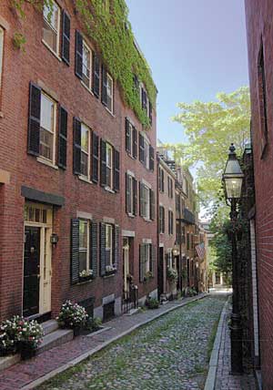
Photo courtesy Greater Boston CVB/ FayFoto
Walk north on Winter Street to Tremont Street, which fronts Boston Common. Though it was not officially landscaped until Frederick Law Olmsted made it the anchor of Boston’s Emerald Necklace, this 50-acre plot is one of the oldest public green spaces in the country. British troops camped here during the War of Independence and the Common was the site of public hangings until 1817.
Walk north on Park Street, across the top of the Common, toward the Massachusetts State House. Completed in 1798, this gold-domed building is actually the Bay State’s second capitol. Designed by Charles Bulfinch, who also helped design the U.S. Capitol, the State House became a template for the design of most statehouses nationwide.
Walk west on Beacon Street and then make a right on Joy Street. Walk two blocks north to Pickney Street and then make a left. The George Middleton House, at No. 5-7, is the oldest African-American house still standing on Beacon Hill, which was the city’s first African-American neighborhood. Middleton fought in the War of Independence.
Walk back to Joy Street, make a left onto it and continue walking north. At No. 46 stands the Abiel Smith School, the first public school in the nation built for the education of African-American children, and behind it is the African American Meeting House. The oldest still-standing black church in America, it was an early gathering place for the abolitionist movement. William Lloyd Garrison founded the New England Anti-Slavery Society here in 1832 and Frederick Douglass gave an important speech here in 1860.
Return to Joy Street and continue walking north until you reach Cambridge Street. Make a right onto Cambridge, cross to the north side of Cambridge and start walking east. A few doors down, at No. 141, is the Harrison Gray Otis House. Built in 1796, it is actually the first of three homes for Otis, all of which were designed by Charles Bulfinch. Otis was politician and businessman who helped ensure that Boston was made the state capital and helped develop Beacon Hill.
Continue walking east on Cambridge Street for several blocks until you reach Sudbury Street. This is the beginning of Government Center. The area was originally called Scollay Square after William Scollay, a militiaman in the War for Independence who went on to become a prominent merchant in the square.
Scollay Square was the site of several quirky moments in Boston’s history. At No. 5½ Tremont Row, Josiah Johnson Hawes opened Boston’s first photography studio in the 1840s—at a time when Daguerreotypes were the main photographic medium. At No. 19 Tremont Row, on September 30, 1846, William Thomas Green Morton became the first dentist in history to give a patient anesthesia.
During the early 20th century, numerous vaudeville and burlesque theaters made their home in the area—which eventually attracted the attention of Boston’s vice squad. By the 1950s, the area was down on its luck and a prime target for redevelopment. The entire area was razed and, working with a master plan designed by architect I.M. Pei, FAIA, transformed into the seat of Boston’s municipal government. The proportions of the brick-clad plaza were loosely modeled after the historic St. Peter’s Square in Rome, but the City Hall building itself is a uniquely 20th-century creation. Designed by the Boston-area firm Kallman McKinnell and Knowles, the building typifies late-1960s Brutalism: a style of architecture marked by its use of muscular concrete forms.
Walk across the plaza on the north side of City Hall to Congress Street. Across the street is the New England Holocaust Memorial. Designed by architect Stanley Saitowitz, FAIA, and dedicated in 1995, its six glass towers represent the six Nazi death camps. They are inscribed by 6 million numbers, representing the 6 million slaughtered Jews.
Walk half a block south on Congress Street until you reach Faneuil Hall. Originally built in 1742, the building was redesigned and expanded by Charles Bulfinch in 1806. In the run up to the War of Independence, patriot Samuel Adams and others gave impassioned speeches here. Behind the building is Quincy Market, one of three long market buildings that originally served as Boston’s main market; in the 1970s, it was converted into an outdoor shopping mall.
Continue south on Congress Street. Ahead of you is the Boston Massacre Site. On March 5, 1770, a dispute between a British soldier and a wigmaker’s apprentice escalated into a scuffle during which British troops shot five colonists dead. To the left, on Court Street, is Massachusetts’s Old State House. Built in 1713—and decommissioned in 1798—it was here that the Declaration of Independence was first read publicly in Massachusetts on July 18, 1776.
Walk west on Court Street and take your first left on Washington Street. Walk one block south to the Old Meeting House. On December 16, 1773, colonists met here and decided to stage a protest against British tariffs on tea. Dressed as Native Americans, the colonists then walked to the waterfront where they sneaked onto a British ship and tossed tea chests overboard in an event dubbed the Boston Tea Party.
Walk one more block south and you’re back at the Hub of the Universe, Downtown Crossing.


Post a comment to this article
Report Abusive Comment