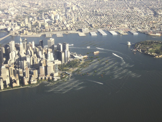
For those of us involved in the 2010 exhibition Rising Currents: Projects for New York’s Waterfront, at New York’s Museum of Modern Art (MoMA), the question we’ve been asked most frequently since Superstorm Sandy is “Could things have been different?” The honest answer is mostly no. The barrier islands and reefs proposed in the Rising Currents show were there to break the waves in storms to form a new public space on the water’s edge, as well as to defend the city. Sandy, in spite of being a tidal surge, was a late-season storm, and the cold temperatures kept the strongest winds at a high altitude, so fewer waves formed. Inside New York’s upper harbor, the waves in Sandy appear to have been less violent. To protect against the tidal surge itself would require more specific and engineered protection in addition to the kinds of natural barriers proposed at MoMA.
Looking back to Sandy, we see how easily we are caught off guard. Thanks to Hurricane Irene in 2011, transit officials knew to shut down the system in advance and move the trains to safety, but they did not seal the road and rail tunnels against flooding. Irene caused the first evacuation in memory, but the lack of severe flooding then led some residents to ignore evacuation orders during Sandy, with terrible consequences. The unexpected flooding of an electrical substation downtown caused an extensive and lasting blackout. Many buildings were made uninhabitable when basement flooding knocked out their utilities. It seems pretty clear that building-code provisions for flood-resistant design and construction had been inconsistently applied at best.
So what can be done? The answer can be found in the nation’s experience mitigating the hazards of earthquakes and extreme winds. Individuals and professional organizations, most notably the Structural Engineers Association of California and the Earthquake Engineering Research Institute, decades ago began pressing local and federal governments while shaping a theoretical basis for earthquake-resistant design. The National Earthquake Hazards Reduction Program (NEHRP), initiated by Congress in 1977, formalized the government’s role and steadily funded basic research. Spurred by the 1989 and 1994 California earthquakes, this led to the development of rigorous, probability-based seismic-hazards maps for the entire country and thoroughly vetted code provisions for buildings and bridges.
There is no national wind-hazards-reduction program, but the field has advanced steadily since the 1960s thanks to the contribution of key wind-tunnel facilities, notably in Ontario as well as, for tornadoes, at the National Oceanic and Atmospheric Administration’s National Severe Storms Laboratory in Oklahoma. Despite great advances in computational fluid dynamics, physical wind-tunnel testing of building models and field measurements of extreme storms are still necessary. The geographer Gilbert White (1911–2006), generally considered the father of floodplain management, wrote in 2001 that “a full range of floodplain management tools should be used to address flooding problems, and assessing the effectiveness of these tools should be done on individual buildings and reaches for floods of up to 500-year frequency.” He succinctly points to what is lacking now in flood-resistant design. For one thing, we don’t understand what happens to individual buildings when water flows rapidly around them in a storm surge. We need physical testing for this just as much as we need to design for the turbulent flow of wind around buildings. YouTube videos of the 2011 tsunami flooding towns in Japan show its importance.
Even more critical is that we don’t have reliable probability-based flood-hazards maps for the built environment executed at the same standards as our seismic- and wind-hazards maps. We need to embark on a sustained national hazards-reduction program for floods that includes these new kinds of maps (incorporating best estimates of the effects of climate change). We also need improved research on the performance of structures in floods and extreme winds, with both numerical simulations and physical testing in large wave tanks. Bills now pending in the House and Senate would combine national seismic- and wind-hazards reduction into one Natural Hazards Risk Reduction Program. These should be expanded to include flood hazards as well, both coastal and riverine, and add the Federal Emergency Management Agency’s flood-insurance program to its purview. The average funding for the NEHRP since 2005 has been $125 million per year. A great deal of good has been accomplished with that money. Considering that the losses associated with recent storms have been at far greater magnitude, it is pretty clear what needs to be done.

Post a comment to this article
Report Abusive Comment